
Snowmobiling in Northern Michigan and the Upper Peninsula
April 2, 2024 – 2:00 pm update: – TUESDAY AFTERNOON – The official Michigan snowmobile season came to a close on Sunday, March 31, 2024. However, the weather forecast is calling for heavy snow starting Tuesday night into Thursday for the Central and Western parts of the Upper Peninsula. Snow totals may be as much as 2 feet in the high country west of Marquette. You can still ride on public land, however, please make sure you know that any place that you ride is public and open for riding. Do not trespass. Trespassing and riding on trails that are not open causes great harm and sometimes means the closing of trails for good.
Check the weather page for the latest weather updates
Check the snow depth map for the areas the have the most snow.
Here are the latest trail reports.
<>
<>
Here’s the Snow Depth Map to help you find regions with the most snow.
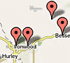
Keweenaw Peninsula — Ironwood / Western U.P.
Also check out John Dee for the latest weather forecasts.
Check the weather page for the latest weather updates and click here for the latest photos.
Check the Snow Depth Map for areas with the best snow.
Here are the latest trail reports.
Check out John Dee and the John Dee Forecast Graphic for his take on this week’s weather.
Complete trailreport.com reports on the web, facebook and twitter:
FACEBOOK – http://www.facebook.com/TrailReport
TWITTER – http://www.twitter.com/TrailReport
Forecasts from Weather Undergound: (Ironwood Forecast) — (Marquette Forecast) — (Newberry Forecast) — (Cadillac Forecast) — (Gaylord Forecast) — (Traverse City Forecast)
NEW: Webcam Map – View webcams throughout Northern Lower Michigan and the Upper Peninsula on our interactive google map.
You can follow the week’s weather forecast at John Dee.
You can track some of the lake effect snow on the Radar Loop here and also get an educated guess on the best regions for snowfall on the Winter Storm Warning Map.
You can view the snow depth map here.
To check temperatures and trail conditions throughout Northern Lower Michigan and the Upper Peninsula click on our new google interactive trail report map
Featured Regions For The Winter of 2013 / 2014
 Cadillac |
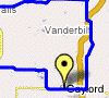 Gaylord |
 Traverse City |
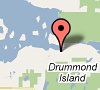 Drummond Island |
 Western U.P. |
Featured Regional Links
Western U.P. – Trail Reports – Webcams
Western U.P. Snowmobile Lodging
Ironwood – Hurley Lodging, – Montreal Haus Rental – Montreal, WI – Classic Motor Inn – Ironwood – Red Birch Haus – Iron Belt, WI – Comfort Inn – Ironwood – The Cedars Motel
Bessemer – Wakefield Lodging – Indianhead Mountain Resort – Regal Country Inn – Wildernest Chalet I & II – Wakefield – The Bluffs Inn – Bessemer – Big Powderhorn Lodging Association – Windsong Lodging – Bessemer – Powderhorn Northwoods Suite – Bessemer – SnowBlind Chalet 1-6 – Powder Hound Lodge
Lake Gogebic Lodging – AJ’s Walleye Lodge – The Timbers Resort – Root Cellar Resort – Bear’s Nine Pines Resort
Watersmeet Lodging – Jay’s Resort
Ontonagon – Porcupine Mountains Lodging – Mountain View Lodges – Scott’s Superior Inn – Superior Shores – Peterson’s Chalet Cottages – Rocky Shores Vacation Home – Porcupine Lodge – White Pine – Sunshine Motel – A Cabin & A Cottage Up North – Konteka Resort – AmericInn of Silver City – A Beach Retreat Cottage
Gaylord Area – Trail Reports – Webcams
Gaylord Snowmobile Lodging – Ray’s Retreat Country Inn – Pine Cone Accommodations – The Waters Inn – Treetops Resort – and more…
Gaylord Snowmobile Rentals – Alpine Snowmobile Rentals – DerMiner’s Parkside Market Snowmobile Rentals – Gaylord Dining
Harbor Springs Area – Trail Reports
Harbor Springs Snowmobile Lodging – Trout Creek Condominium Resort

Traverse City Area – Trail Reports
Traverse City Lodging – Ranch Rudolf – Honor Motel – Honor – Bayshore Resort – Pointes North Beachfront Resort Hotel – Cherry Tree Inn and Suites – Lake ‘N Pines Lodge – Crystal Mountain Resort & Spa – and more…
Traverse City Snowmobile Rentals – Blue Sky Snowmobile Rentals
Traverse City Dining – Peegeo’s – Ranch Rudolf
<>
Postings From Trail Report Pages On Facebook
FROM Grand Marais Sno-Trails Assoc. >> Great turn out this morning. A beautiful day to be out on the trails...don't forget to get your raffle ticket! #grandmarais #newberry
FROM Grand Traverse Area Snowmobile Club >> The first meeting of the season is in the books. Thanks to Peegeo's for supplying pizza for the meeting! Peegeos is a long time supporter of GTASC. Let's return the favor and support them whenever possible.
It was announced at the meeting that GTASC will be receiving a new Dubie drag for this season. (Our current drags are 20+ years old). This will be a welcomed addition to the fleet and cut down on our current maintenance time and cost. There is still plenty of work that needs to be performed on the trails. We will be brushing this Sunday. If you can, come on out and give us a hand. We would appreciate it! #traversecity

This content isn't available right now
This content isn't available right now
When this happens, it's usually because the owner only shared it with a small group of people, changed who can see it or it's been deleted.FROM Grand Traverse Area Snowmobile Club >> The work never ends.....we will be brushing this Sunday, September 22nd. A trail lunch and refreshments will be served. Please meet at the groomer barn, Carpenter creek road and Jack Pine at 9 am. We could use your help. Soon, the snow will be flying and all this work will be worth it. See you there! #traversecityThe work never ends.....we will be brushing this Sunday, September 22nd. A trail lunch and refreshments will be served. Please meet at the groomer barn, Carpenter creek road and Jack Pine at 9 am. We could use your help. Soon, the snow will be flying and all this work will be worth it. See you there!
FROM Grand Traverse Area Snowmobile Club >> We will be brushing this Sunday, September 8. Please meet at the grommer barn, 7299 Carpenter Creek road at 9:00 am. We're hoping to finsh up trail 510. Refreshments and a trail side lunch will be provided. We could really use your help. Hope to see you there. #traversecityWe will be brushing this Sunday, September 8. Please meet at the grommer barn, 7299 Carpenter Creek road at 9:00 am. We're hoping to finsh up trail 510. Refreshments and a trail side lunch will be provided. We could really use your help. Hope to see you there.
Jennifer Loos Jon Adams
This content isn't available right now
This content isn't available right now
When this happens, it's usually because the owner only shared it with a small group of people, changed who can see it or it's been deleted.<>
<>