
Snowmobiling in Northern Michigan and the Upper Peninsula
January 6, 2026 – 4:30 pm update: – TUESDAY AFTERNOON – Slight warm up in the forecast for most of this week with highs in the high 30s and low 40s. Most trails have been groomed up nicely and the base in strong, especially in the U.P. so the trails should be able to survive the warm up this week. Cold weather and snow returns on Friday. Conditions should improve during the weekend and should be in very good shape during the early part of next week.
Check all the local reports for the latest updates…
Check the snow depth map for the areas the have the most snow.
Check back for updates…
Check the weather page for the latest weather updates
Check the snow depth map for the areas the have the most snow.
Here are the latest trail reports.
<>
<>
Here’s the Snow Depth Map to help you find regions with the most snow.
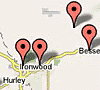
Keweenaw Peninsula — Ironwood / Western U.P.
Also check out John Dee for the latest weather forecasts.
Check the weather page for the latest weather updates and click here for the latest photos.
Check the Snow Depth Map for areas with the best snow.
Here are the latest trail reports.
Check out John Dee and the John Dee Forecast Graphic for his take on this week’s weather.
Complete trailreport.com reports on the web, facebook and twitter:
FACEBOOK – http://www.facebook.com/TrailReport
TWITTER – http://www.twitter.com/TrailReport
Forecasts from Weather Undergound: (Ironwood Forecast) — (Marquette Forecast) — (Newberry Forecast) — (Cadillac Forecast) — (Gaylord Forecast) — (Traverse City Forecast)
NEW: Webcam Map – View webcams throughout Northern Lower Michigan and the Upper Peninsula on our interactive google map.
You can follow the week’s weather forecast at John Dee.
You can track some of the lake effect snow on the Radar Loop here and also get an educated guess on the best regions for snowfall on the Winter Storm Warning Map.
You can view the snow depth map here.
To check temperatures and trail conditions throughout Northern Lower Michigan and the Upper Peninsula click on our new google interactive trail report map
Featured Regions For The Winter of 2013 / 2014
 Cadillac |
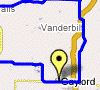 Gaylord |
 Traverse City |
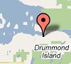 Drummond Island |
 Western U.P. |
Featured Regional Links
Western U.P. – Trail Reports – Webcams
Western U.P. Snowmobile Lodging
Ironwood – Hurley Lodging, – Montreal Haus Rental – Montreal, WI – Classic Motor Inn – Ironwood – Red Birch Haus – Iron Belt, WI – Comfort Inn – Ironwood – The Cedars Motel
Bessemer – Wakefield Lodging – Indianhead Mountain Resort – Regal Country Inn – Wildernest Chalet I & II – Wakefield – The Bluffs Inn – Bessemer – Big Powderhorn Lodging Association – Windsong Lodging – Bessemer – Powderhorn Northwoods Suite – Bessemer – SnowBlind Chalet 1-6 – Powder Hound Lodge
Lake Gogebic Lodging – AJ’s Walleye Lodge – The Timbers Resort – Root Cellar Resort – Bear’s Nine Pines Resort
Watersmeet Lodging – Jay’s Resort
Ontonagon – Porcupine Mountains Lodging – Mountain View Lodges – Scott’s Superior Inn – Superior Shores – Peterson’s Chalet Cottages – Rocky Shores Vacation Home – Porcupine Lodge – White Pine – Sunshine Motel – A Cabin & A Cottage Up North – Konteka Resort – AmericInn of Silver City – A Beach Retreat Cottage
Gaylord Area – Trail Reports – Webcams
Gaylord Snowmobile Lodging – Ray’s Retreat Country Inn – Pine Cone Accommodations – The Waters Inn – Treetops Resort – and more…
Gaylord Snowmobile Rentals – Alpine Snowmobile Rentals – DerMiner’s Parkside Market Snowmobile Rentals – Gaylord Dining
Harbor Springs Area – Trail Reports
Harbor Springs Snowmobile Lodging – Trout Creek Condominium Resort

Traverse City Area – Trail Reports
Traverse City Lodging – Ranch Rudolf – Honor Motel – Honor – Bayshore Resort – Pointes North Beachfront Resort Hotel – Cherry Tree Inn and Suites – Lake ‘N Pines Lodge – Crystal Mountain Resort & Spa – and more…
Traverse City Snowmobile Rentals – Blue Sky Snowmobile Rentals
Traverse City Dining – Peegeo’s – Ranch Rudolf
<>
Postings From Trail Report Pages On Facebook
FROM Trails End Lodging >> Looking for something fun to do this weekend? It’s a great weekend to visit the Upper Peninsula with the Tahquamenon Country Sled Dog Race 2026 happening January 10th & 11th! Experience the excitement of winter in the UP as mushers and their incredible dogs take on the snowy trails. Wishing all the racers the best of luck—we hope everyone has a safe and amazing race! #newberry
Such a fun thing to see!!
FROM The Chippewa Sno-Kats Trail Club, Inc. >> Trail Report !!
Groomers were out this evening and did trail #113 , #2 and #16 going to Sagola. The Sagola trail only goes to the Michi-Aho resort because of new landowners.
Big update !!
Trail #111 and #18 have been brushed and cleared and ready to groom. They will be grooming the trail tomorrow morning.
We would like to give a big appreciation and Thank you to Kim Nylund , Scott Oberlin and Jeff Ball for making this happen. Thank you guys for your hard work !!! #snowphotosTrail Report !!
Groomers were out this evening and did trail #113 , #2 and #16 going to Sagola. The Sagola trail only goes to the Michi-Aho resort because of new landowners.
Big update !!
Trail #111 and #18 have been brushed and cleared and ready to groom. They will be grooming the trail tomorrow morning.
We would like to give a big appreciation and Thank you to Kim Nylund , Scott Oberlin and Jeff Ball for making this happen. Thank you guys for your hard work !!!

FROM Les Cheneaux Snowmobile Club & Grooming Report >> What a day! Bully 19 went down to limp mode last night so I took Bully 18 to help Bully 17 to get it out of the woods and to the road. We were able to get it back to the barn. Groomer operators working as a team.
PEREMARQUETTE TRAILS UPDATE via Pere Marquette Snowmobile Club Inc. >> Trails were rolled last night hopefully they will hold up thru warmup. We have a couple of issues to address someone is taking signs down at 15 th avenue on trail 30 11/2 mile east of 66 2 weeks ago it was a stop sign last night there was a stop ahead sign missing so be alert in this area. Also we are still working on leaning trees in Clare county. It is passable but watch out for branches hanging down. Think snow Ride right. #peremarquette
NEWBERRY AREA UPDATE via TASA Tahquamenon Area Snowmobile Association >> So do to it not getting cold enough at night we will be holding off on grooming until we start getting freezing temperatures again sorry for the inconvenience but this will help get the snow and ice off of the trees so some of the branches come back up, especially over by the Falls thank you.. #newberrySo do to it not getting cold enough at night we will be holding off on grooming until we start getting freezing temperatures again sorry for the inconvenience but this will help get the snow and ice off of the trees so some of the branches come back up, especially over by the Falls thank you
WEATHER UPDATE via US National Weather Service Marquette Michigan >> After the light snow showers push through the eastern half of the U.P. this evening, expect calmer and warmer conditions with the sun peeking out from time to time Wednesday as early Thursday. However, precipitation could return as early as late Thursday. #miweather #keweenaw #westernup #marquette #munising #seney #newberry #soo #straitsareaAfter the light snow showers push through the eastern half of the U.P. this evening, expect calmer and warmer conditions with the sun peeking out from time to time Wednesday as early Thursday. However, precipitation could return as early as late Thursday. #906wx #miwx
WEATHER UPDATE via US National Weather Service Gaylord Michigan >> Precip ends tonight, although fog remains with reduced visibility. Rain returns Thurs PM into Fri as temps moderate. However, icy secondary roads could develop, along with ice jams along rivers, and perhaps localized minor flooding. Next chance for snow is this weekend. #miweather #gaylord #cadillac #benzie #traversecity #petoskey
FREDERIC - GAYLORD AREA UPDATE via Sledheads of Frederic , Michigan Snowmobiling >> Not liking the weather forcast for the rest of the week and coming weekend. Ended up closed again yesterday as there was another blessing of 6 inches of snow and we took off on another great ride of untouched snow, leaving Frederic and up towards mount Frederic and lakes of the north to starvation lake and back to Frederic. Lunch at the hide away and back to Frederic. About 150 miles of prime riding between sunday and monday. Sundays ride took us to lovells for a great pizza. Now time to get to real work today. Pics below are of the Jordan Valley groomers with a giant project on the trail. The guys were there to get the track back on the groomer. It actually came off a few days ago but they had to gather up equipment to put it back together. Wow what a huge project. A big thank you to all those volunteer guys. Thanks for checking in. Pete #gaylord #snowphotos
frederic-mi.com
Not liking the weather forcast for the rest of the week and coming weekend. Ended up closed again yesterday as there was another blessing of 6 inches of snow and we took off on another great ride o…<>
<>